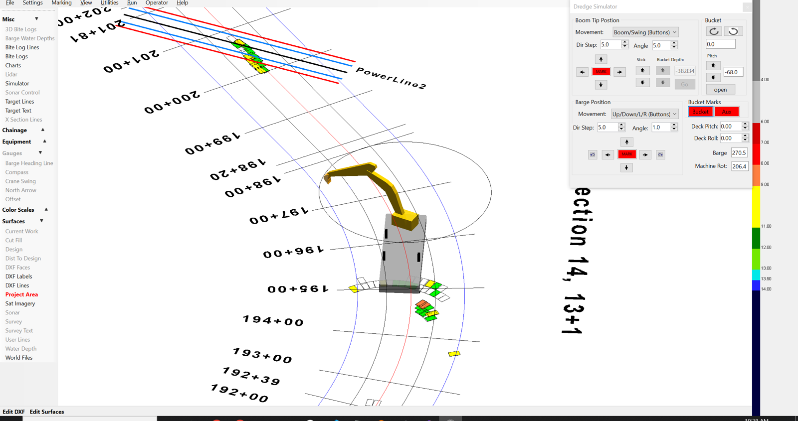
ClamVision supports excavator-based dredging with full articulated arm modeling. Boom, stick, and bucket angles are measured continuously and combined with GPS and inclinometer data to calculate the three-dimensional position of the bucket tip throughout the dig cycle.
Excavator sensor integration
ClamVision reads excavator geometry from a combination of angle encoders, inclinometers, and GPS:
- Boom angle — measured by encoder or inclinometer on the main boom pivot
- Stick angle — measured by encoder on the stick pivot
- Bucket rotation — measured by encoder on the bucket pin
- Machine rotation — measured by encoder or compass on the upper works
- Machine pitch and roll — measured by inclinometer on the carbody
These measurements, combined with the known link lengths entered during machine setup, produce a continuous kinematic solution for bucket tip position.
3D excavator model on screen
The on-screen equipment model moves in sync with the physical machine. The operator and supervisor see an accurate representation of boom reach, dig depth, and lateral position without any manual input. Grade is shown numerically and graphically — how many tenths or hundredths above or below the design surface the bucket currently sits.
Wireless and cabin-mounted configurations
ClamVision supports both wired and wireless sensor configurations for excavators. Wireless inclinometer transmission is supported for installations where running cable through articulating joints is impractical.